Nottinghamshire UK gets new map of mobile network cover and performance
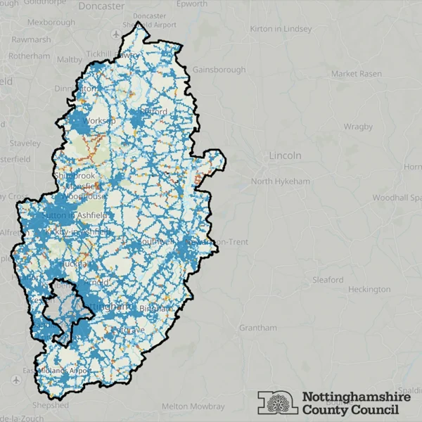
The Nottinghamshire County Council (NCC) in England and consultancy firm FarrPoint have just completed their “most comprehensive survey of mobile coverage across the county to date“, which has resulted in the release of a new coverage map to help give residents a clearer picture of where mobile services are strong and where gaps remain. EE was found to deliver the “best coverage overall“.
The survey, which was conducted between March and July 2026, involved FarrPoint’s kit being sent to travel along 4,728 km of roads around Nottinghamshire, including motorways, main A&B roads, local roads and smaller rural routes.
“Rather than relying only on mobile operators’ predicted coverage maps that often don’t match reality, the survey measured actual mobile signal and resident experience on the ground,” said the announcement. FarrPoint then used the results from this to create an interactive online map for the public that can be found following the link below.
Advertisement
The map allows residents to search by address or postcode to see what mobile network coverage is like in their area and compare the performance of different mobile operators, including EE, O2, Vodafone and Three UK. You can also pick specific locations to see what kind of mobile broadband speeds (download, upload and latency / ping) were recorded from each operator.
FarrPoint said they combined signal strength, download and upload performance and latency into a combined Coverage Performance measure, to better reflect the service a mobile user might experience. This showed that Three UK had the largest areas of “No Coverage” and “Poor Coverage“, followed by O2 and Vodafone, while EE recorded the best coverage overall.
Councillor Bert Bingham said:
“This map is vital as we want to make sure our residents and businesses are as well connected as possible and can access accurate information about which mobile phone operators perform best where they live, work and travel. Afterall, many residents need a strong mobile signal for things like accessing health care services, operating smart meters, electric vehicle charging and even on-line shopping, especially for those who may not be able to get out and about.
This project as a whole gives us a much clearer understanding of where coverage is working well and where improvements and action may be needed, especially in rural areas where there may be potential gaps in coverage.”
The map has also been designed to be more accessible, including a colour-blindness-friendly colour scheme, helping as many people as possible understand the information.
FarrPoint’s Map of Mobile Coverage in Nottinghamshire
https://experience.arcgis.com/experience/5f3c1a0d8aa74c35b7198e55fba7a4fa/page/Checker






Mark is a professional technology writer, IT consultant and computer engineer from Dorset (England), he also founded ISPreview in 1999 and enjoys analysing the latest telecoms and broadband developments. Find me on X (Twitter), Mastodon, Facebook, BlueSky, Threads.net and Linkedin.








« Connected Britain reveals 2026 UK broadband award winners















Privacy Notice: Please note that news comments are anonymous, which means that we do NOT require you to enter any real personal details to post a message and display names can be almost anything you like (provided they do not contain offensive language or impersonate a real person's legal name). By clicking to submit a post you agree to storing your entries for comment content, display name, IP and email in our database, for as long as the post remains live.
Only the submitted name and comment will be displayed in public, while the rest will be kept private (we will never share this outside of ISPreview, regardless of whether the data is real or fake). This comment system uses submitted IP, email and website address data to spot abuse and spammers. All data is transferred via an encrypted (https secure) session.