Point Topic Launch UK Maps of Broadband Cover by Local Authority

Telecoms analyst firm Point Topic has today introduced a new interactive map of broadband connectivity across UK Local Authorities (LAs), which is said to “reveal significant disparities in digital infrastructure” and aims to support LAs by helping to inform their local digital strategies. The maps are also freely available to the public (recent data only).
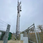
A quick look at the new maps appears to show various data points being split by LAs and districts, including local FTTP + gigabit broadband coverage (inc. roll-out progress), details on average internet speeds, the availability of different networks, population / business premises, affordability and coverage details for other technologies (e.g. FTTC, ADSL and Cable / Coax).
The data is quite useful and allows you to see how each area has changed over time, although it doesn’t allow users to drill down to the level of individual premises and instead offers a more generic overview of each local authority.
Advertisement
Oliver Johnson, CEO at Point Topic, said:
“Despite substantial investment and progress in broadband infrastructure, digital inequalities remain a pressing issue. The data highlights areas where Local Authorities need targeted support to bridge connectivity gaps and ensure no community is left behind.
It’s not just about faster speeds; connectivity underpins economic development, social inclusion, and local services. Local Authorities need clear strategies to address the gaps in coverage and take-up of broadband.”
The announcement also makes reference to 4G and 5G mobile networks, although we couldn’t see any data for those networks being shown on the maps themselves.


Mark is a professional technology writer, IT consultant and computer engineer from Dorset (England), he also founded ISPreview in 1999 and enjoys analysing the latest telecoms and broadband developments. Find me on X (Twitter), Mastodon, Facebook, BlueSky, Threads.net and Linkedin.


« O2 UK and Ontix Expand 4G Mobile Small Cells into Plymouth


What does “TalkTalk” mean on these maps? Apparently they have their own full fibre network in Mid Sussex, but this is news to me…
Same here in Kent.
I drilled down to my local council ward.
It states that we have BT, Talk Talk & Trooli.
We only have BT here!
My husband used to be a local Parish Councillor, so we know exactly where the ward boundary is.
Trooli, when they were called Call Flow Solutions, said that they were going to install an FTTC cabinet about 10 years ago, but abandoned the idea, after Openreach built their own RDSLAM cab on the village green.
I’ve just double checked, by looking at the Think Broadband map and also typed a dozen or so village postcodes into the Trooli availability checker … nada!
Those data, for Q4 2024, say that we have 100% Gigabit coverage and 97% FTTP.
As of today, both are less than 1%.
Sure, once the Openreach FTTP build completes, which is due to start next month according to BIDB, it should cover somewhere in the mid 90’s percentage wise, but not as of today, let alone Q4 2024.
TBB better?
I can’t speak for the rest of the country, however the TBB map clearly shows the 2 properties, in the LA ward where I live, that have Openreach FTTP (which are fed from a neighbouring head-end exchange) which is correct.
So that’s 2 properties, out of a ward total of 467, that have FTTP, which Point Topic calculate to be 97.3%
They also state that the ward has 1,026.81 premises.
Apart from the fact that it’s more than double the actual number, what the …. heck is the .81 all about?
The are no premises which straddle the boundary; there used to be, but the Boundary Commission tweaked the map, back in 1973, to fix that problem.
All I can think of is that they are counting the UPRNs of agricultural land & woodland.
We have one area of woodland, which is divided into hundreds of little plots, where folk can plant a tree and scatter granny/grandad’s ashes.
Fibre-to-the-Urn perhaps?
I forwarded a link, to this article, to several District Councillors from neighbouring wards.
Their replies can be distilled into:
What a load of/pile of … etc., etc.
The coverage map and data is ——-
Been struggling for years to get fttp at my location. It’s being shown as covered by fttp, which is a lie. Their numbers are nonsense. Liars, that is all I can say.
In the Competitor view they seem to have BT in the “Gigabit Suppliers by LA ward” but “Openreach” in the “Overbuild” matrix. Slipshod understanding of who is building the network? Ignoring every other supplier who could resell Openreach-based service? A cynical way to encourage business towards BT retail? (with some kickback towards PointTopic perhaps?)
Like others I am not convinced of the data. An area I know well also has “TalkTalk” listed everywhere, alongside “BT” (presumably Openreach). The local altnet is also listed even in areas where they are building but probably not yet RFS.
I would also be concerned about the “gigabit capable” premises number. For example in areas where OR is the only “gigabit capable” provider and where they installed ECI kit – are those premises being treated as gigabit capable?
Having tried and failed to interpret, and then believe the data for AB33 postcodes, I’m afraid this is, at best, usable by a layman.
However, thank you for making it available to the layman! Better than anything I’ve come to expect from OFCOM.