The Clever Way Augmented Reality May Help Rollout Full Fibre

The on-going rollout of gigabit-capable Fibre-to-the-Premises (FTTP) based broadband ISP networks across the UK, as well as in other countries, may soon be starting to benefit from the use of Augmented Reality. This can help engineers to see – with more clarity than ever – exactly what sort of infrastructure already exists under the surface.
Not so many years ago if you wanted to dig new fibre optic cable into the ground then the tools at your disposal were much more limited and disruptive, but today a growing number of civil engineers are gaining access to modern technologies that can help to make the job easier, safer and faster. This in turn can also reduce the deployment cost, which makes it possible to reach more premises for the same money.
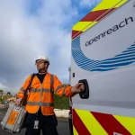
Some recent examples of such improvements can be seen in various areas, such as Openreach’s (BT) use of Ground Penetrating Radar (GPR) to help map existing infrastructure and design new cable routes (here), or the more general adoption of compact Remote Controlled Mole Ploughing machines.
Advertisement
One other area that is now starting to get quite a lot of attention is Mixed Reality (MR) and Augmented Reality (AR) systems, which can often be combined with other methods to help visualise exactly what already exists under the ground or plan for future work. Technologies like this, when correctly deployed and operating at a high-accuracy, can help to prevent incidents (i.e. damage to existing infrastructure) and thus delays.
Take the following “fully automated” (i.e. doesn’t require manual 3D model preparations) example from vGIS, where reality capture AR is draped over the physical world with sub-10cm accuracy and without external GNSS (Global Navigation Satellite System), using a patented GNSS-less calibration method.
Admittedly this only works, in the way depicted above, when you do a 3D scan of the works before covering them up (i.e. it’s only of benefit to future works), such as via proper georeferencing kit, although processing the data through photogrammetry like this to create 3D models can also be done with nothing more than a device capable of capturing high-resolution images or videos.
According to vGIS, the model above was created from the visuals captured with a regular Smartphone (Android or iOS), paired with high-accuracy GNSS (only used for the capture stage). We understand that this approach could potentially also be used alongside GPR (mentioned earlier) and Electromagnetic Detectors to visualise existing infrastructure, where no pre-scans exist, but it wouldn’t be as clear as what you see here.
Advertisement
“The reality mesh is combined with GIS [Geographic Information System] and BIM [Building Information Modelling] information in real-time by the vGIS engine, so in a single unified view, the User sees the reality mesh, GIS and BIM information all at once. The possibilities for damage prevention and productivity improvements are endless,” said vGIS.
Technologies like this, when correctly deployed and operating at a high-accuracy, can help to prevent incidents (i.e. damage to existing infrastructure), although the new AR solutions are no substitute for good old-fashioned common sense. One other danger is the assumption that what you see is all that exists, which may be incorrect if based on an out-of-date scan (this goes back again to that point about common sense).
Nevertheless, it’s now possible to imagine a future were an agreed standard and approach could help to facilitate everybody using and sharing such data, while keeping it current with new changes. A lot of mistakes could be solved by taking such an approach, but we’re still a long way from that becoming reality. Still, technologies like this give us a fun glimpse into the much more technologically driven future of street works.


Mark is a professional technology writer, IT consultant and computer engineer from Dorset (England), he also founded ISPreview in 1999 and enjoys analysing the latest telecoms and broadband developments. Find me on X (Twitter), Mastodon, Facebook, BlueSky, Threads.net and Linkedin.


« BT Sport TV App to Finally Get Dolby Atmos Sound on Saturday
Study of 5G and 4G Congestion Finds Three UK Suffers Most »


I can see issues with this from a survey perspective. First, even with everything mapped perfectly, this would require either RTK or a simcard to get sufficient accuracy on site, as one assumes they’ll use GPS/GNSS for position. The compass would also need to be very accurate, or it would need you to travel in a direction to use to orient it.
I won’t go into the mess of unknown services underground.
Agreed. It’s an excellent idea in principle and I hope it develops further. The real world usage requires a much higher precision than this, this is a rough tool at best by the looks of it.
The reality capture and reality capture visualization happens with support from RTK-enabled receivers, including highly portable Leica FLX100. The model placement is done with up to 1cm level accuracy. Orientation is done with sub-0.2° accuracy thanks to the patent pending positioning tech from vGIS.
@Archie, numerous real-life scenarios don’t require 1mm accuracy. Some do, and the reality capture is done with high-accuracy LiDAR scans. However, many ordinacy scenarios don’t require 1mm accuracy. With the cost per scan in single dollars, this technology is used by 100s of companies around the world to analyze issues, preserve evidence and build up archives of excavations.
@vGIS Team.
Respectfully, you won’t be offended if I don’t take YOUR word for it.
Concept is excellent, don’t really care for the reply. Reflexive and defensive replies from companies marketing this isn’t winning you any points. Think about how you reply to people properly before making that jump.
There is something very suspicious about these videos. What’s the source of the data?
They show highly-detailed, full colour 3D images of the insides of trenches – including how cables are twisted together and lay across each other, and even leaves lying in the side.
This definitely doesn’t come from a GIS, nor from ground-penetrating radar. Neither is going to store or show the location of leaves! Don’t forget that the trench doesn’t even *exist* any more. It has been filled in, and is all just solid ground now.
I can see two possibilities:
1. The images come from photographs taken from multiple angles while the trench was open. That’s quite cool – but very few areas will have photographs like this on file.
2. It’s all synthetic: a computer-artists view of what a trench *might* look like, how the cables *might* be laid across each other, and so on. In this case, it’s worse than a GIS map. It gives a false sense of accuracy, when the GIS data just says cable goes from position (x1,y1) to (x2,y2) at nominal depth (z).
No.1, as somewhat explained in the article. You can either get that at the same time as doing the 3D scan (lasers + image capture) with a specific piece of kit or take lots of images from different angles etc.
The technology at work has been around for a few years, but applying it to street works and adding in other data points is much newer.
The videos shows a 3D model of the previously excavated trench overlaid over the same location a few weeks later, when the trench is filled. The model is captured with photogrammetry. Another option is to use a consumer-grade LiDAR built into the 2020 iPad Pro and iPhone 12 Pro.
Some visuals are displayed with 10cm or so accuracy (without GNSS). Others are placed with up to 1cm accuracy with support from high-accuracy GNSS.
Lots of old dinosaurs here, who can’t fathom how a technology like this can work. Ask children, they’ll tell you how images are captured with 3D scans and GPS co-ordinates, angles, are precisely calculated with sensitive instruments.
I wonder if these doubters know that other fantastic technologies already exist and are in use, such as VR headsets, with extremely high 4k + resolution at high refresh rate (120Hz+).
Looks very good, but can’t believe that no one else has commented about the cables which go to the cabinet in the first video at 2:15 clearly appear to be out by far more than 10cm. Still will give engineers a great idea of what’s underground once an easily accessible database of videos is built up.