Rubbish Trucks to Help Map 4G Mobile Coverage in Mid Wales

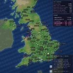
The Growing Mid Wales (GMW) programme has launched a major new project in Mid Wales, which aims to identify areas with poor 4G mobile (mobile broadband) coverage and network capacity (“mobile not-spots“) by installing “advanced mobile data-capturing devices” on waste collection vehicles across Powys and Ceredigion.
Under this approach, the waste collection vehicles will continue their regular routes, while ensuring thorough data collection and without the additional logistical costs of needing to hire a specialist team and vehicles to achieve a similar outcome. This cost-effective approach provides an efficient solution for mapping mobile coverage across the region.
Data from the four main Mobile Network Operators (MNO) – EE, O2, Three UK, and Vodafone – will be collected. GMW will then use this data to develop targeted projects and interventions to address connectivity challenges in key areas, which will help to enhance digital infrastructure across the mid-Wales area.
Advertisement
Supported by local authorities in Powys and Ceredigion and funded by the UK’s Shared Prosperity Fund from the UK Government, the project will also produce a coverage checker tool. This free tool, to be launched on the Growing Mid Wales website “later this summer“, will allow people to check mobile coverage in their areas and determine the most suitable mobile providers for their needs, enhancing digital transparency.
GMW Team Statement
“We are thrilled to launch this groundbreaking project in Mid Wales. Identifying and addressing ‘mobile not-spots’ and areas of poor network capacity is crucial for the region’s development.
This initiative aligns with GMW’s overarching goals, supporting decision-making for digital infrastructure deployments, regional economic development, and innovation. Having better information about coverage will increase our ability to work with commercial providers to address genuine not-spots and problem areas in coverage. In turn, this will help us pinpoint the areas where public intervention may be required to accelerate and/or enable deployment to ensure we have safe, reliable coverage across the region.”
Admittedly rubbish trucks can’t reach every location and so this sort of mapping will invariably have its limits, but it’s still an interesting and novel approach that should produce some useful results. GMW is understood to be collaborating with mobile network analysts at Streetwave, who have been chosen for their “groundbreaking and cost-effective approach“, crucial to the project’s success and impact.
No doubt if this works, we might well see similar projects cropping up elsewhere in the UK.


Mark is a professional technology writer, IT consultant and computer engineer from Dorset (England), he also founded ISPreview in 1999 and enjoys analysing the latest telecoms and broadband developments. Find me on X (Twitter), Mastodon, Facebook, BlueSky, Threads.net and Linkedin.


« Rural UK Full Fibre Broadband ISP Truespeed Top 100,000 Premises


Certainly one to watch – seems promising, will have to wait and see what the results are like before other similar projects get trialed elsewhere.
While they might not cover everywhere, they will presumably cover all premises (assuming the rubbish trucks visit all households to collect rubbish) which in of itself is highly valuable information.
Great idea using existing infrastructure for a secondary purpose. One other great innovation I’ve seen is crowd sourcing. I’ve been using Roam recently which maps not only signal, but quality and estimated speeds from your phone and rewards you for doing so:
https://play.google.com/store/apps/details?id=xyz.roamnetwork.roamapp&referrer=utm_content%3Dnickmjweaver196%26utm_source%3Drefer
NPerf already does this for the whole of the UK, the free app is on the play store and similar. It is not 100% due to relying on the public, but it is pretty good. You can add data to it by just running the app in active mode and driving / walking around.
Emergency services jumped to my mind as another possible group to work with i.e. Coastguard, Mountain/Lowland rescue
Mobile coverage has already been mapped by the Ambition North Wales and FarrPoint project https://www.ispreview.co.uk/index.php/2022/11/4g-mobile-cover-across-main-transport-routes-in-north-wales.html
Why hasn’t this map been made available to the public so we can understand which network to be on?
That’s North Wales and this is mid Wales (ie Powys and Ceredigion). There’s pretty much no overlap. This also covers routes that are not main transport links, ie far more useful for rural communities