Ordnance Survey Picked to Build National Underground Asset Register

In an unsurprising move, Ordnance Survey (OS) has confirmed that they’re working with Atkins to build the UK Government’s new National Underground Asset Register (NUAR), which is a digital map of underground pipes (water etc.) and cables (broadband, power etc.) that could help reduce accidental damage.
Much as we reported last month (here), the Government believes there is huge potential for location data to improve the way that national infrastructure is planned, built and managed, from informing where our future “gigabit-capable broadband” and 5G mobile networks need to go, to planning how and where to connect utilities, and designing new housing developments etc.
One of the ways such a map could help is by reducing the amount of accidental damage that occurs to existing infrastructure, which one estimate suggested could cost up to around £2.4bn each year. But this does rather ignore the fact that alternative platforms, such as the LSBUD (Line Search Before You Dig) service, already exist to provide a similar facility.
Advertisement
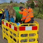
Nevertheless, NUAR’s digital map is expected to be pieced together over the next 3 years, starting in the North East of England, Wales and London (Northern Ireland to follow). The associated Geospatial Commission previously appointed Atkins to deliver the Build Phase of NUAR, and they in turn have now appointed OS to help create the map.
Chris Tagg, Head of Geospatial Solutions at OS, said:
“We are delighted to be part of this exciting transformative project. The development of a UK wide underground digital map of the nation’s utilities has been an innovation focus for OS for several years and it is great that the National Underground Asset Register is now entering the build phase.
We are looking forward to working with Atkins, 1Spatial and the other partners on the build and sharing our world leading geospatial data, as well as our know how and learnings from supporting customers across the utility sector for many years.”
None of this will come as much of a surprise because OS helped to build some of the concepts that ultimately led to the NUAR. For example, they were part of a similar 2018 project with the Northumbrian Water Group. On top of that there was OS’ own Project Iceberg, which explored how to better capture, collect and share data about underground assets and geological conditions.
OS has also recently been a member of a consortium, with utility companies and local authorities in the North East, developing a digital data exchange platform as part of one of the Geospatial Commissions NUAR pilot projects.
The aforementioned pilot, underpinned by geospatial data, enabled any of the participating organisations to see an integrated, common and consistent map view of the underground assets in the location they are looking to excavate, with the most crucial operational information available, on a single device.
Advertisement


Mark is a professional technology writer, IT consultant and computer engineer from Dorset (England), he also founded ISPreview in 1999 and enjoys analysing the latest telecoms and broadband developments. Find me on X (Twitter), Mastodon, Facebook, BlueSky, Threads.net and Linkedin.


« Guernsey ISP Sure to Deploy 1Gb FTTP Broadband Across Island UPDATE
Cuckoo Launch 1Gbps UK Broadband Plan with 1 Month Term »


Better data is a good thing.
More usable, better data is an even more good thing.
All that said I am not sure how this deals with the:-
– 11kVA line across a back garden shown on EDF’s plans that did not exist and could never have done so; and
– foul drain run that went down an entire street to the rear of the house that was not on the TW layouts; and
– rainwater drainage marked a combined on the TW plans.
Just some real examples of the garbage data we wrestle with on a daily basis.
Other than that all good!
I might be barking up the wrong tree here but I wonder whether this would help to highlight the number of properties across the country which are on a “looped” electricity supply?
We are on such a supply – cable comes into our house from the street and then goes from our meter onto our neighbours meter (other half of the semi). It means that we can’t have an EV charger fitted, unless the supply is un-looped – which means digging up the neighbours drive-way for a new cable and installing a new meter etc. in their house, which they are not in the slightest bit keen on. So we’re stuck using the “granny” charger.
I understand that the same thing applies to heat-pumps, you can’t have them installed on a looped service without it first being un-looped. Given that EVs and heat-pumps are being pushed by the UK gov over the next 10-15 years to reach emissions targets, I feel like it is something of a ticking time-bomb the number of houses on a loop and I’ve wondered before whether there was any single database of how many.
Where we are the DNO will un-loop for free (if you’re getting an EV charger or heat-pump), although only if your neighbour agrees of course. I understand that it isn’t free everywhere, and have the feeling that as more and more of these scenarios come to light over the coming years the subsidies available might dwindle…
It was only as recently as 1978 that the National Joint Utilities Group trialled something like this in Dudley. Don’t things move quickly in this digital world!
Does anyone know how you apply to become a member of the NUAR. I have done some initial searches on how to apply, but not finding anything at the moment.