Streetwave Prep Largest Mobile Network Coverage Survey in UK History
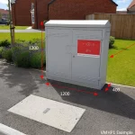
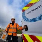
Network analyst firm Streetwave is working with the River Severn Partnership Advanced Wireless Innovation Region (RSPAWIR) to conduct what they’re called the “largest mobile coverage survey ever conducted in the UK“. This uses bin lorries to survey the coverage and speed of 4G and 5G mobile (broadband) networks across 33 West Midlands (England) and Wales councils.
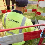
The use of bin collections to map mobile network coverage and data performance recently become quite popular (here, here, here, here and here). In this setup, refuse collection vehicles are installed with four off-the-shelf Smartphones using software from Streetwave on top, which run continuous network tests (once every 20 metres in rural areas and 5m in urban areas) as the vehicles go about their routes.
The data this creates is typically more detailed and accurate than the flaky estimates of mobile network coverage that are so often produced by mobile operators and Ofcom, which is because bin lorries need to go down almost every single road in order to conduct their collections and do so on a regular basis. Suffice to say that this makes them a uniquely useful and cost-effective resource for conducting this sort of study.
Advertisement
In addition, portable data collection units will be made available to residents to test coverage along “off-road locations including farms and walking paths“. The new survey will then go a step further by surveying the coverage of Long Range Wide Area Networks (LoRaWAN) too, which harness a small slice of lower frequency radio spectrum (usually bands like 868MHz or 915MHz) to support relatively slow and low power data connections.
LoRaWAN networks tend to run at sub-Megabit broadband speeds (some variants can handle several Megabits per second), which makes them ideal for linking Internet of Things (IoT) style sensors. Several operators have deployed these (e.g. UK ISP Connexin), but there have been few detailed studies of their actual reach.
Professor Mark Barrow, Joint Chair of the River Severn Partnership, said:
“This survey represents a landmark effort to transform connectivity across the River Severn region. Once collected, we are making this data accessible to the region’s 3.5 million residents through Streetwave’s coverage checker. This solution will allow residents to easily check network coverage at specific addresses, empowering them to find the best possible connectivity solutions for their needs.”
The data collected is said to “serve a dual purpose“. Firstly, it will help businesses identify the most effective connectivity solutions for their operations, empowering them to make informed decisions that enhance their productivity and competitiveness.
Secondly, it will enable the River Severn Partnership to lobby mobile operators more effectively, advocating for necessary improvements in digitally excluded communities to benefit residents and businesses alike. Assuming, that is, the residents are happy for new masts to be built or even upgraded with more kit. People often want the service, but not always the new infrastructure that it requires, which can be tricky to resolve.
Advertisement
In addition, similar surveys have often enabled Streetwave to make an address-based coverage checker available so that people can see how specific locations perform (it’s unclear if the same will apply above), although in an ideal world they’d also be complementing this with a visualisation of that coverage (e.g. interactive map) to make surveying local connectivity a lot easier for people. But we’ve yet to see anything like that.
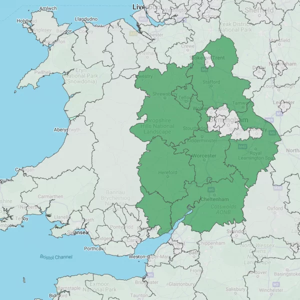
List of the 33 UK Council Areas Being Surveyed
- Shropshire Council
- Telford & Wrekin Council
- Herefordshire Council
- Monmouthshire County Council
- Worcestershire County Council
- Bromsgrove District Council
- Malvern Hills District Council
- Redditch Borough Council
- Worcester City Council
- Wychavon District Council
- Wyre Forest District Council
- Warwickshire County Council
- North Warwickshire Borough Council
- Nuneaton & Bedworth Council
- Rugby Borough Council
- Stratford District Council
- Warwick District Council
- Gloucestershire County Council
- Cheltenham Borough Council
- Cotswold District Council
- Forest of Dean District Council
- Gloucester City Council
- Stroud District Council
- Tewskesbury Borough Council
- Staffordshire County Council
- Cannock Chase District Council
- East Staffordshire Borough Council
- Lichfield District Council
- Newcastle-Under-Lyme Borough Council
- South Staffordshire District Council
- Stafford Borough Council
- Staffordshire Moorlands District Council
- Tamworth Borough Council


Mark is a professional technology writer, IT consultant and computer engineer from Dorset (England), he also founded ISPreview in 1999 and enjoys analysing the latest telecoms and broadband developments. Find me on X (Twitter), Mastodon, Facebook, BlueSky, Threads.net and Linkedin.


« 62,000 Premises in Scotland Benefit from R100 Fibre Broadband Build


Wonder why the West Midlands conurbation and the city of Stoke isn’t part to the survey?
Because it requires the local authority to participate in it.
Brilliant lateral thinking use of the tech.
Pity it wasn’t around before we were promised the replacement of FM radio with DAB!!
Wait and watch the SPs squirm when real world coverage data hits the fan…
Great idea. Ofcom says Vodafone is not available indoors at my location while EE will be limited. Reality is Vodafone 4G/5G is fantastic where as EE is actually awful inside/outside. Buying on that map could be an expensive affair.
We had a broadband fault that required a service call and I nearly bought an EE 5G modem box thing with ethernet to be failover but borrowed one first from a friend and it was pretty much useless.
These kinds of lateral thinking using existing infrastructure seem a know brainer. Want to do a weekly survey of local areas without a massive fleet of cars and people just strap it to a bin lorry.
Great initiative, but centralised with a large business taking on a public contract and money from local authorities.
There are plenty of decentralised equivalents out there which are run by local residents on their own devices, Roam (https://play.google.com/store/apps/details?id=xyz.roamnetwork.roamapp&referrer=utm_content%3Dnickmjweaver196%26utm_source%3Drefer) being one of them, which rewards them for providing continuous, real-world coverage.
Never heard of Roam before. Generally Cellmapper has the best data although it’s not great for showing what speeds you can expect.
I used to constantly contribute with Rootmetrics back when it was a publicly available service as it was great to see real world user coverage for the areas which the network claimed would or would not have signal.